Abbeyknockmoy Abbey
Abbeyknockmoy Abbey is a ruin in the countryside 10.9 km south-east of Tuam, County Galway. Knockmoy Abbey is within 6 m.
Ruined Cistercian abbey founded in 1189 by Cathal Crobhdearg O'Connor on the River Abbert, known for the medieval wall paintings in its chancel, one of only four such survivals in Ireland.
- Kind
- Ruins
- From Tuam
- 10.9 km south-east
The map does not yet record a phone number, a website or opening hours for Abbeyknockmoy Abbey. Anyone can add them on OpenStreetMap; this page picks the change up at the next refresh.
The story of Abbeyknockmoy Abbey
Cathal Crobhdearg Ua Conchobair, king of Connacht, founded the abbey in 1189 and settled it with Cistercian monks from Boyle in Roscommon. Its Latin name, the Monastery of the Hill of Victory, and its Irish one, Cnoc Muaidhe, both survive in the placename Abbeyknockmoy. Most of what stands dates from the early thirteenth century, with later work in the fifteenth and sixteenth.
It had a hard start: William de Burgh plundered it in 1202 or 1203 and raiders came again in 1228 and after. On 24 May 1542, in the dissolution, its abbot Hugh O'Kelly surrendered it to Henry VIII, and afterwards local people called it simply the chapel with the big door.
The plan is the standard Cistercian one: a church with a wide nave, two aisles and north and south transepts each holding two chapels, a rib-vaulted chancel where the monks worshipped while the lay brothers used the nave, a vaulted chapter room lit by a fine three-light window, and dormitories above the chancel and sacristy. The cloister is a graveyard now. A carved king, perhaps the founder, looks out from the south-west corner of the church, his nose and chin gone but eyes, hair and crown intact.
What draws visitors is the painting. The north wall of the chancel was once covered in medieval wall paintings, worked in tempera rather than true fresco, of which Ireland has no medieval examples at all; Knockmoy's are one of just four such groups in the country. Weather has taken part of them, and in the 1980s the Office of Public Works roofed the section that holds them.
Written from Wikipedia, "Knockmoy Abbey" (CC BY-SA 4.0, read 2026-09-18). Facts only from those sources; the words are ours.
Abbeyknockmoy Abbey in pictures
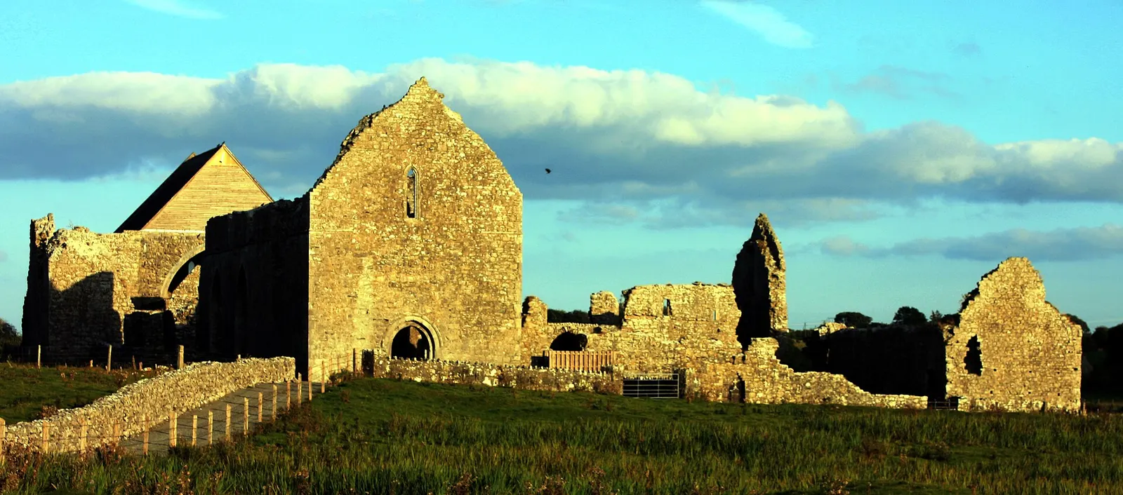
DanielecDalton, CC BY-SA 4.0 via Wikimedia Commons

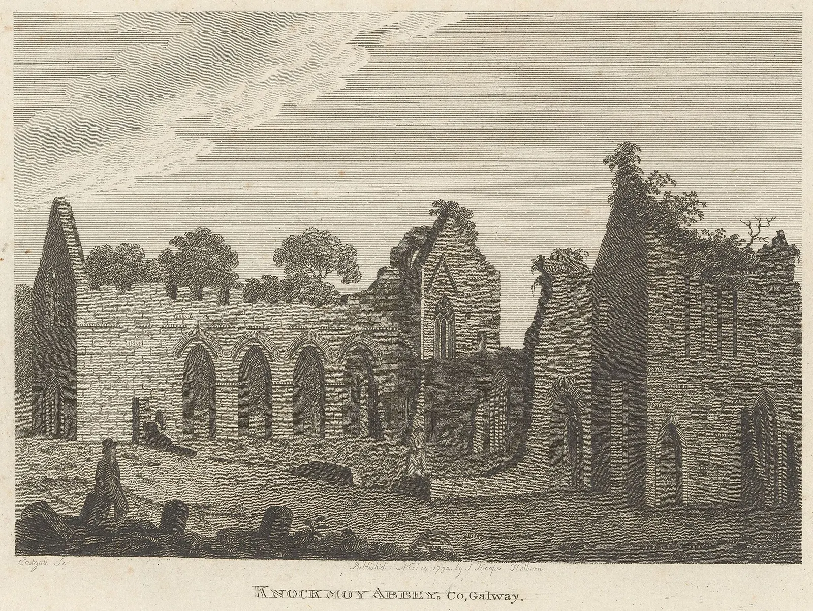
Rijksmuseum, CC0 via Wikimedia Commons

Getting to Abbeyknockmoy Abbey
- From the town
- 10.9 km south-east of the Square in a straight line; it is out in the country, so allow for the roads.
- Directions from where you are
- Open the model above, tap the pin and choose “Directions here”; the route is drawn from your own position.
Around it
Other sites within 3 km: Knockmoy Abbey (6 m) and Ballynapark (3.0 km).
Tower houses, the castles of the Irish countryside
Many of the ruins mapped around Tuam are tower houses, the tall stone farm-castles of the later Middle Ages, built to be lived in with a small household and defended when it came to that, with a vaulted floor against fire, corner bartizans and a machicolation above the door.
Written from Wikipedia, "Tower house" (CC BY-SA 4.0); the words are ours.
Within a short walk
- Knockmoy Abbey6 mAbbeys
Other ruins around Tuam
- 5.1 km
- 8.7 km
- 17.9 km
- 20.5 km
- 22.0 km
Questions people ask
Where is Abbeyknockmoy Abbey?
What is the history of Abbeyknockmoy Abbey?
Are there other ruins nearby?
Source record: OpenStreetMap way/317222018, read on 2026-09-18. The street is the mapped address where there is one, otherwise the nearest named road. Distances are straight lines.