J. L
J. L is a jeweller on The Square in Tuam, County Galway, 125 m north-east of the Square. The Galway Roast, Corralea Court Hotel and Supermac's are within 18 m.
- Kind
- Jewellers
- Street
- The Square
- From the Square
- 125 m north-east, 3 min on foot
- Website
- corraleacourt.com
- Parking
- BoI Car Park on Dublin Road, 68 m away
- Bus stop
- Tuam (Vicar Street Cathedral), 170 m away
The map does not yet record a phone number or opening hours for J. L. Anyone can add them on OpenStreetMap; this page picks the change up at the next refresh.
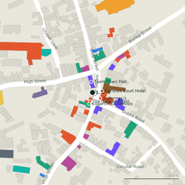
Plan of the surrounding 300 m
Getting to J. L
- On foot
- 3 minutes from the Square, 0.26 km along the streets, ending on The Square.
- By car
- Park at BoI Car Park on Dublin Road, 68 m away. Tuam is 30 km from Galway city on the N17.
- By bus
- The nearest stop is Tuam (Vicar Street Cathedral), 170 m away.
- Directions from where you are
- Open the model above, tap the pin and choose “Directions here”; the route is drawn from your own position.
While you are there
13 places to eat and drink within 300 m: The Galway Roast (17 m), Supermac's (18 m), Krugers Bar (22 m) and The Sportsman's Inn (38 m) and more.
11 shops within 300 m, including SAB Fashion, Eason and NCBI.
The Square itself has 12 named places on the map, and 2 car parks along it.
Within a short walk
- The Galway Roast17 mCafés
- Corralea Court Hotel18 mHotels
- Supermac's18 mTakeaways
- Tuam Town Hall20 mCouncil offices
- Kilgarriff's Chemists22 mPharmacies
- Krugers Bar22 mBars
- SAB Fashion27 mClothes shops
- AIB29 mBanks
Also on The Square
- AbbeyCafés
- Corralea Court HotelHotels
- Duffy's PharmacyPharmacies
- Krugers BarBars
- Leo's PharmacyPharmacies
- McGinty'sPubs
- NCBICharity shops
Everything on The Square (12 places)
Questions people ask
Where is J. L?
How far is J. L from the centre of Tuam?
Source record: OpenStreetMap node/6831949248, read on 2026-09-18. The street is the mapped address where there is one, otherwise the nearest named road. Distances are straight lines.