Temple Jarlath
Temple Jarlath is a grave yard on High Street in Tuam, County Galway, on the Square. Galway County Council, Tuam Library and Apache Pizza are within 81 m.
- Kind
- Grave yard
- Street
- High Street
- From the Square
- On the Square
- Parking
- The Shambles Car Park on Vicar Street, 79 m away
- Bus stop
- Tuam (Vicar Street Bon Secours) (Bus Éireann), 180 m away
The map does not yet record a phone number, a website or opening hours for Temple Jarlath. Anyone can add them on OpenStreetMap; this page picks the change up at the next refresh.
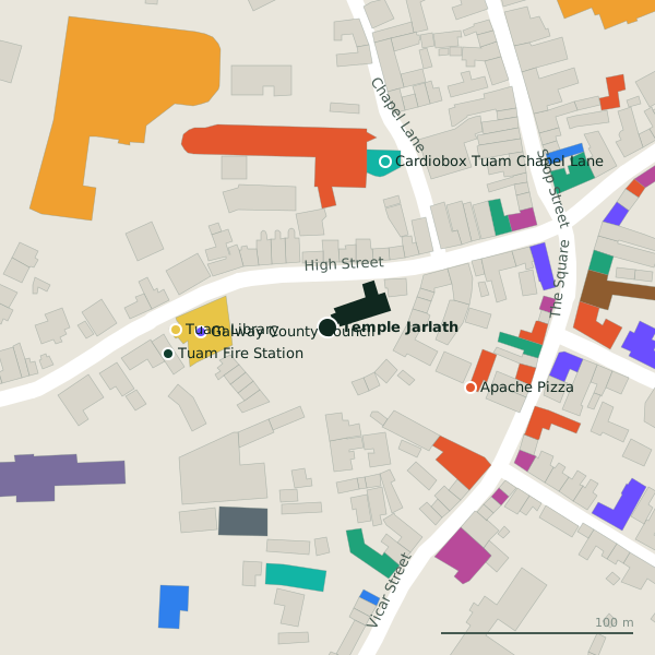
Plan of the surrounding 300 m
Temple Jarlath in pictures
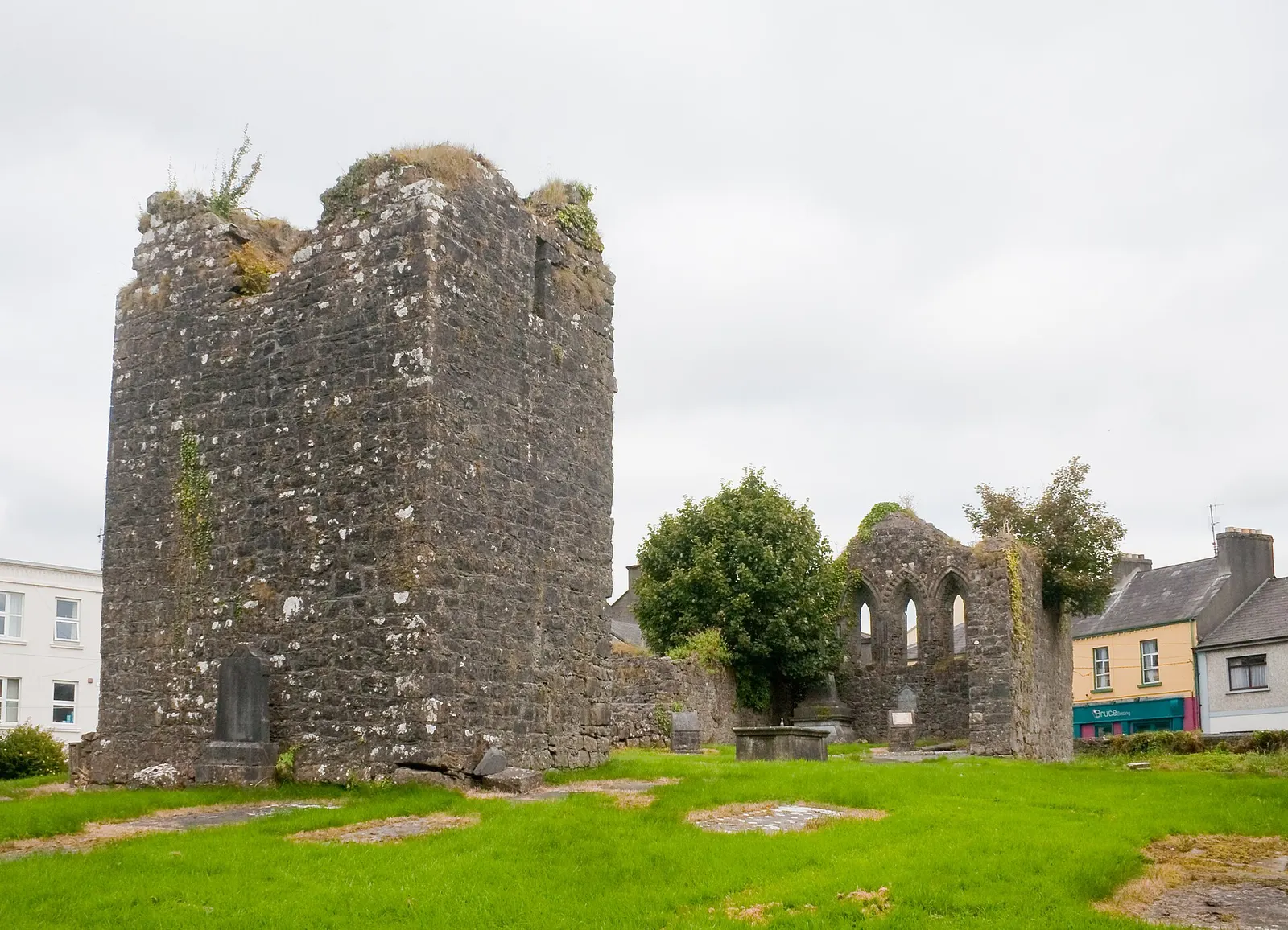
Andreas F. Borchert, CC BY-SA 4.0 via Wikimedia Commons

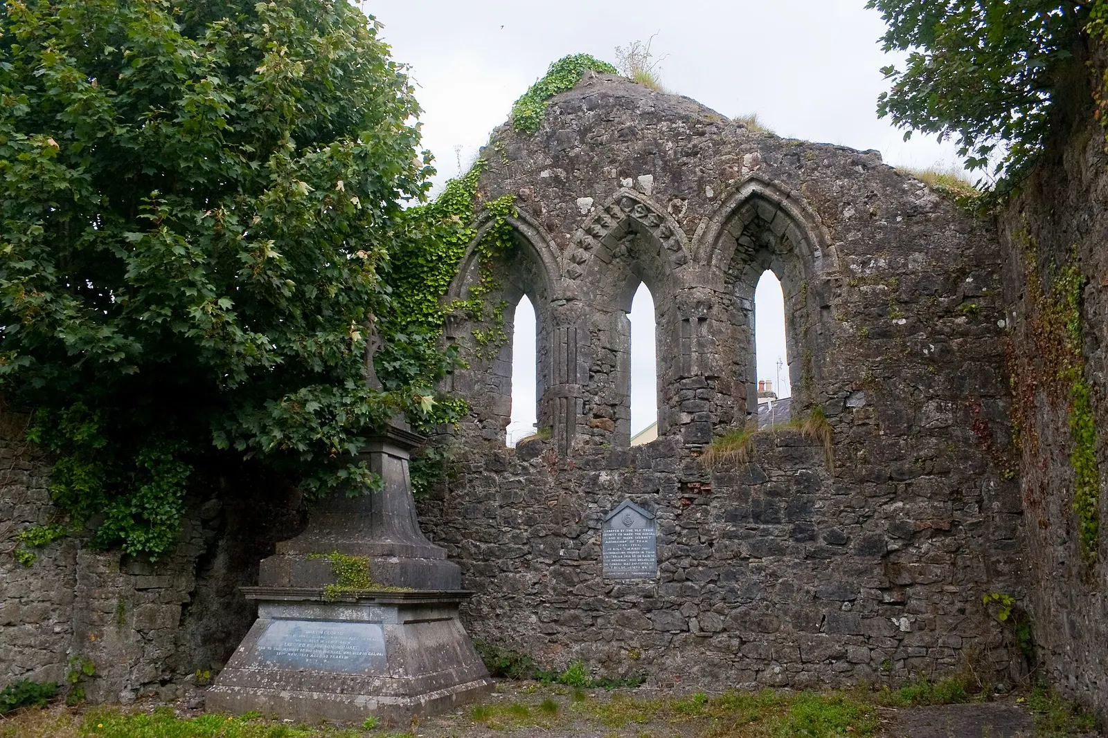
Andreas F. Borchert, CC BY-SA 4.0 via Wikimedia Commons

Getting to Temple Jarlath
- On foot
- 1 minutes from the Square, 0.06 km along the streets, ending on High Street.
- By car
- Park at The Shambles Car Park on Vicar Street, 79 m away. Tuam is 30 km from Galway city on the N17.
- By bus
- The nearest stop is Tuam (Vicar Street Bon Secours), served by Bus Éireann, 180 m away, with a shelter.
- Directions from where you are
- Open the model above, tap the pin and choose “Directions here”; the route is drawn from your own position.
While you are there
13 places to eat and drink within 300 m: Apache Pizza (81 m), Golden Pizza (107 m), The Sportsman's Inn (107 m) and The Connaught Arms (110 m) and more.
12 shops within 300 m, including SAB Fashion, J. L and Tiny Toes.
High Street itself has 7 named places on the map, and 1 car park along it.
Within a short walk
- Galway County Council66 mCouncil offices
- Tuam Library79 mLibrary
- Apache Pizza81 mTakeaways
- Tuam Fire Station84 mFire station
- 91 m
- High Cross Pharmacy100 mPharmacies
- Golden Pizza107 mRestaurants
- 107 m
Also on High Street
- EasonBookshops
- Galway County CouncilCouncil offices
- High Cross PharmacyPharmacies
- Saint Marys CathedralChurches
- Tuam Fire StationFire station
- Tuam LibraryLibrary
Questions people ask
Where is Temple Jarlath?
How far is Temple Jarlath from the centre of Tuam?
Source record: OpenStreetMap way/331708404, read on 2026-09-18. The street is the mapped address where there is one, otherwise the nearest named road. Distances are straight lines.